
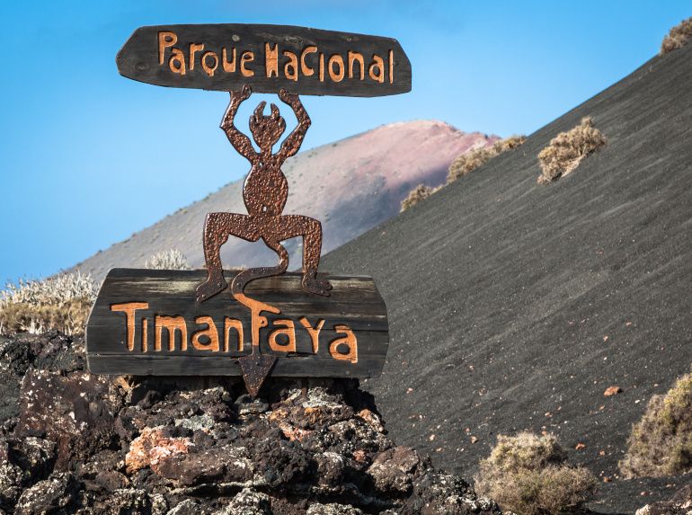
The Timanfaya Natural Park is a natural area that has been little transformed by human exploitation or occupation. Due to the beauty of its landscapes, the representativeness of its ecosystems, or the uniqueness of its flora, fauna or geomorphological formations, it has ecological, aesthetic, educational and scientific values whose conservation deserves preferential attention. In these areas, the use of natural resources may be limited, prohibiting in any case those incompatible with the purposes that have justified its declaration. It was declared a National Park in 1974. Decree 2615/1974 of August 9. (BOE, No. 223 of September 17, 1974). It has an area of 51 km² and represents the recent volcanism that has occurred in the Canary Islands, being the only National Park in the Canary Islands that borders the sea.
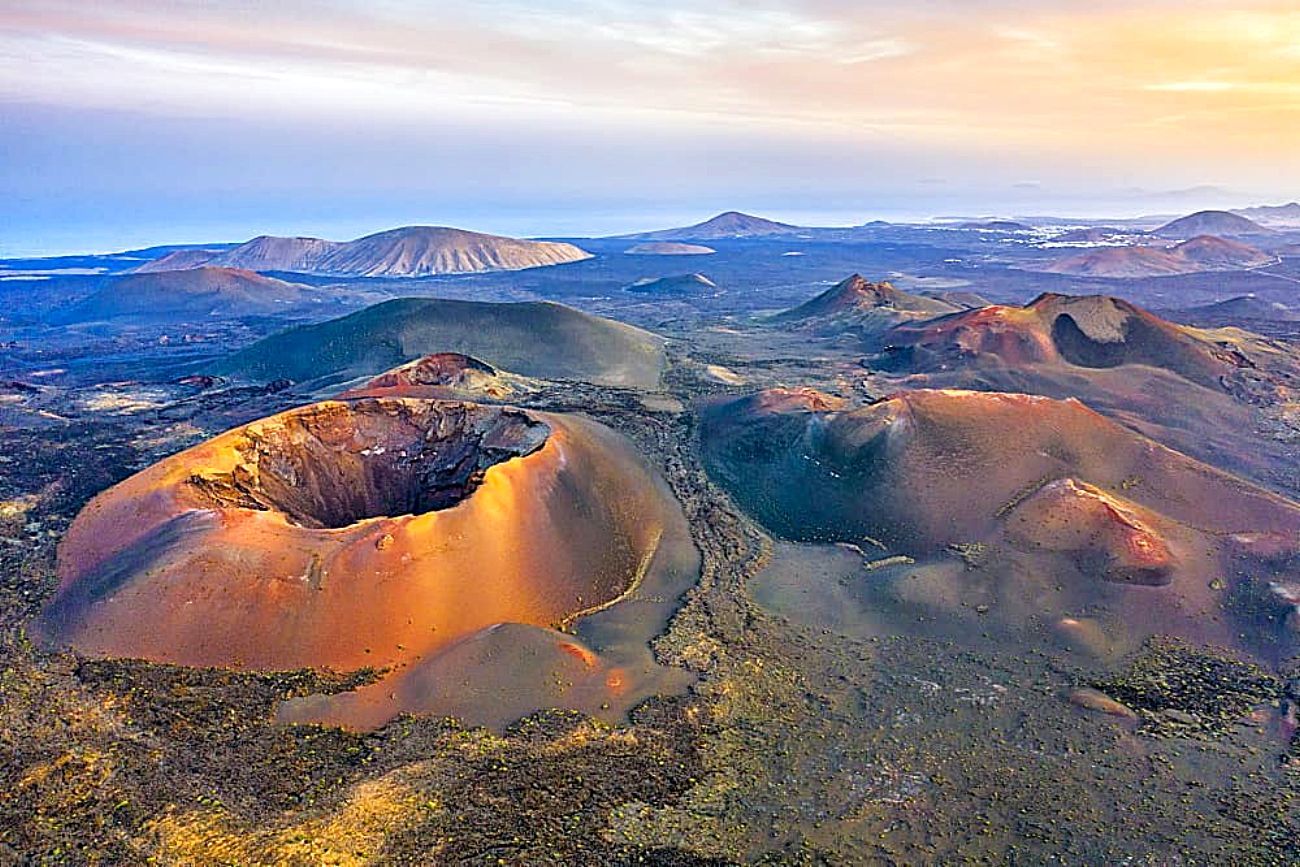
Timanfaya National Park covers almost a quarter of the area covered by the volcanic eruptions that occurred in the 18th century, one of the most important volcanic series in world volcanism, not only because of the enormous quantity of materials thrown out but also because of the long-lasting emission of volcanic materials since it began on 1 September 1730 and stopped spitting fire on 16 April 1736, and after almost 90 years of relative calm a second phase occurred in 1824, giving rise to the formation of the Tinguatón, Tao and Chinero volcanoes, the latter being within the current boundaries of the Park. From these eruptions, new craters, layers of lava, slag and ash fields emerged on the surface, which began in the Timanfaya plain, giving rise to a mysterious lunar landscape enhanced by a rare polychromy of red, black, ochre and grey colours, contrasting in many cases with patches of lichen that have already begun to colonise the newly created lands. According to the chronicles, these were the most productive plains on the island, formed by old clay plains that supported extensive fields of cereals. This entire extensive area was buried, leaving numerous villages such as Santa Catalina, Tingada, Maretas, Peña Paloma, Rodeos, Mazo, etc. buried in its depths.
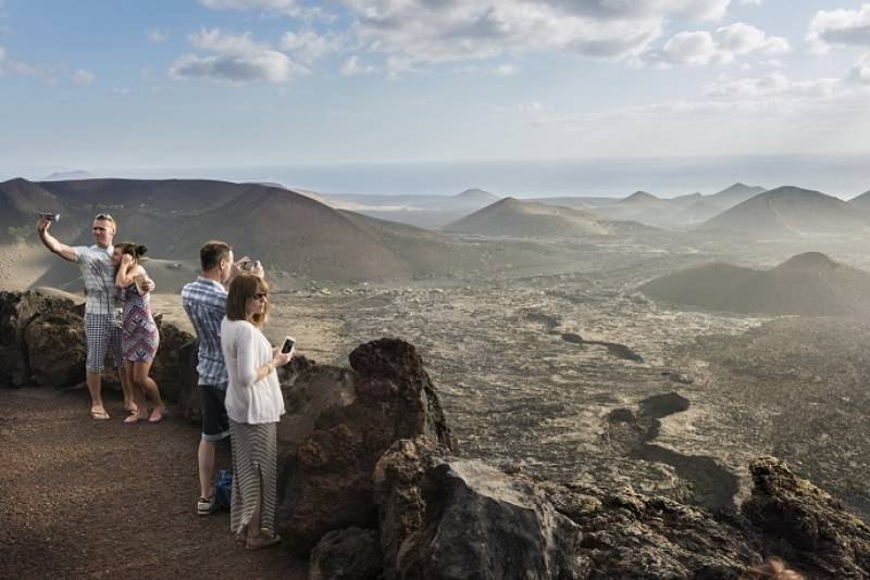
This Park brings together various geomorphological structures, notable for their high world-wide volcanological interest; Volcanic tubes, Hornitos, Sea of lava, volcanic bombs, etc. On the Islet of Hilario, an area that according to legend takes its name from the man from Lanzarote who, after fighting in the Philippine war, lived as a hermit on the islet for more than half a century, with no other company than his camel, the thermal anomalies of the terrain are the cause of astonishment and joy in the visitor, who witnesses how a bucket of water introduced into some pipes buried in the ground is transformed into a geyser of boiling steam, due to a residual magma chamber located three kilometers deep, which reaches 100 to 200 degrees Celsius on the surface, consuming any combustible element. From the natural viewpoint of Montaña Rajada located at 350 m. above sea level we can admire one of the most extraordinary landscapes that nature is capable of offering, formed by an extensive sea of lava that extends to reach the sea, making this tour an unforgettable visit.
The Timanfaya National Park contains within itself a landscape of incalculable value, not only for its beauty, in which different soils, shapes and textures are present, but also for being able to count on a magnificent laboratory in which various plant species (White Salado, Tabaibas, etc.) and animals (Hary Lizard, Shrew, etc.) try to colonize the new lands. However, in the case of birds that are not usually noticed by the visitor, the park welcomes important species such as the Bulwer's Petrel, the Cory's Shearwater, the Egyptian Vulture, the Osprey, etc.
In short, nature, although it once filled the population with terror by ruining fertile plains and grazing areas, houses and entire villages with many of their inhabitants, has managed to compensate years later for this unpleasant situation with one of the most visited National Parks in all of Spain; leaving significant income for the island and an unforgettable experience for the visitor.
In 1970, following the strategy of the Lanzarote artist Don Cesar Manrique Cabrera to protect our landscapes, to highlight the emblematic island places and to provide them with a certain tourist benefit, it was the turn of the mountains of fire in the heart of the Timanfaya National Park. (The technical project was drawn up by the architect Eduardo Cáceres in 1966) The idea of building a restaurant in the area known as the “Islote de Hilario” was conceived, which is precisely where the ground is hottest due to a residual magmatic pocket. Due to these thermal conditions, where at just 6 metres depth there is a temperature of 400 degrees, the technical problem of this construction and the materials to be used becomes evident. A problem that Jesús Soto masterfully solves by waterproofing the floor and allowing the heat to escape through the central oven and some side exhausts that are the current gorse burners and water vapour jets.
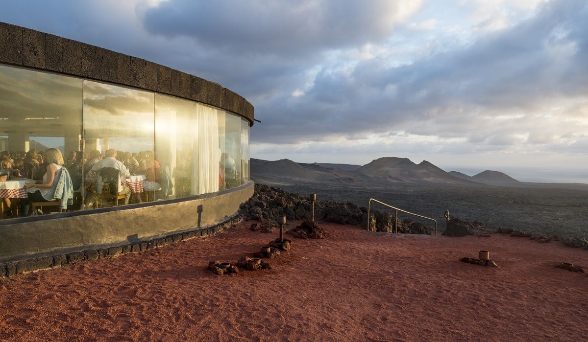
The restaurant floor is circular, surrounded by large windows like viewing points, with simple decoration; the highlight is the lamp hanging from the ceiling of the restaurant, whose branches are frying pans. Another small room, also glazed, shows a skeleton of the camel, the symbol of the Lanzarote peasantry that Don Cesar Manrique always had in mind. The entire building is covered with carved stones so as not to clash with the landscape, although due to the unique landscape it does not completely blend in with the terrain as Don Cesar has achieved with other tourist centres on the island. Its appearance is that of an enigmatic object perched on the top of the mountain. The name of the Devil is chosen because of the tremendous heat that it gives off from the bowels of the earth, the eternal home of the devil. Thus, this is the emblematic symbol of the place. Guided bus excursions to follow the route of the Volcanoes depart from the Devil's restaurant; restricting the free movement of private vehicles within it to protect the delicate landscape from excessive crowding and possible deterioration.